
Locate a Washington Township Street
A Washington Township street directory search should begin with an address, not a name. The county assessment search ties a situs to a parcel lead. County GIS then helps verify the parcel outline, nearby roads, and adjoining lots. The County Clerk's recorded-land index can test an owner name against a deed or mortgage. Historical directories and local collections can add an earlier household reference. Each step narrows a different question, so the result is more reliable than treating a street listing as a current contact list.
- Enter the address in the assessment portal's Location field after selecting Washington district 0818.
- Save the exact situs, owner-style entry, block, lot, and postal label shown in the result.
- Use Gloucester County GIS to confirm the parcel and identify immediately adjoining parcels.
- Search the County Clerk land-record portal for recorded parties and the instrument trail.
- For an older household question, ask GCHS for the relevant directory, telephone book, newspaper, or family-history material.
Record what each source actually says. A deed supplies a recorded transfer. An assessment row is an ownership and valuation lead. A directory is a dated listing. None alone certifies present residence.
Washington Township District 0818 Field Guide
The NJ Assessment Records Search is the starting form for a Washington Township street directory search. It opens with Clayton selected, so choose Washington, district 0818, first. The search form can use a Current Owners/Assmt List or Deed/Sr1a List, simple or advanced search, and several result formats. Search by Location for a street or partial situs. Once the address is found, the Block and Lot fields are more reliable handoffs to GIS and land records than a postal city label alone.
| Portal control | Street-directory use |
|---|---|
| Database | Choose Current Owners/Assmt List or Deed/Sr1a List based on the record question. |
| District | Select Washington, 0818. The opening 0801 selection is Clayton. |
| Search mode | Simple Search and Advanced Search are available before entering criteria. |
| Location, Owner Name, Block, Lot | Use the known address first, then save the parcel identifiers for the next step. |
| Qualifer | Use the portal's own spelling when checking the displayed field. |
The assessment search form shows the database, district, output, and address-search controls used to begin a Washington Township street search.
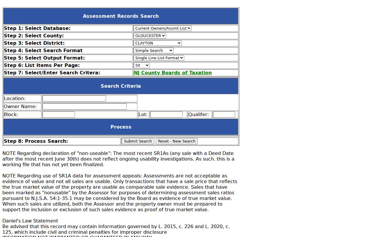
The screenshot makes the district selector and parcel fields visible, including the important 0818 setting for Washington Township.
Washington Township Parcel Geography
GIS is the geographic part of the street directory method. Open the county's GIS route, locate the street or subject parcel, and compare the parcel boundary with the address and block/lot recorded in assessment data. Immediately adjoining parcels can be identified from their boundaries, but a road, creek, common area, or municipal line can make a visually nearby parcel non-adjacent. Save the map observation with the parcel number rather than treating a screen view as a legal description.
The research confirmed the county GIS route and ArcGIS viewer, but it did not capture a reliable live list of layers, popup fields, historical imagery dates, or export controls. Those items should be checked on the live map when they matter. GIS supports a street-by-street context check. It does not prove current occupancy or reveal a complete neighborhood roster.
Washington Township Deeds by Address
After the parcel is identified, the County Clerk's land-record system provides the recorded-document trail. Search every plausible owner name, including initials and name variants, then write down the grantor, grantee, instrument type, date, book and page or instrument number, municipality, and legal description. A recorded deed can reveal an earlier chain for the same parcel, but the current assessment name may have changed since the last recording. The Record Room is the fallback when the online index is unavailable or a copy is needed.
Online printing is reported as free on the Clerk's real-estate page, while ordinary deed copies can be $0.05 per page and certification adds $2. County payment guidance changed beginning July 1, 2026, so the live Clerk page should be checked before a counter visit. Daniel's Law may allow an index row while restricting an image or physical page. A missing image is a protected access limit, not a reason to search around the redaction.
Gloucester County real-estate records instructions identify the official portal, Record Room, copy route, and current warnings for a deed-chain search.
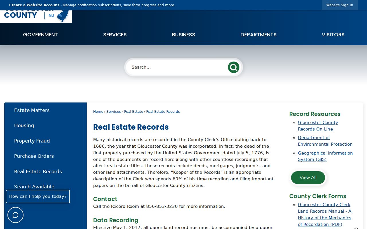
Land-record instructions are the bridge from a Washington Township parcel lead to the recorded documents that support an address history.
Washington Township Street Record Sources
A street directory can pull together several address-keyed sources, but each has a narrow role. Use the parcel identifiers as the link between them. County GIS adds a map view. Assessment data provides the searchable block and lot. The Clerk records instruments. The municipal OPRA form can request a dated existing public record, including a municipal-lien or 200-foot-list item. The state voter tool is a person-specific status check, not a street-wide roster.
| Address-keyed source | Washington Township value | Keeper | Access channel |
|---|---|---|---|
| Assessment record | Situs, owner-style entry, block, lot, assessment and sales lead | Gloucester County assessment system | Public search portal |
| GIS parcel map | Parcel boundary, road context, adjoining parcel geography | Gloucester County GIS | County GIS page and ArcGIS viewer |
| Land-record index | Grantor, grantee, instrument, legal-description and date trail | Gloucester County Clerk | Portal, Record Room, or copy request |
| Municipal public document | Specified property, notice, minutes, plan, or 200-foot-list record | Washington Township custodian | Written OPRA form |
| Historical holdings | Older address or household clue | Gloucester County Historical Society | Catalog, library visit, or research request |
For one name found along a street, switch to the Washington Township resident lookup workflow instead of expanding a broad address search. It is designed for careful verification across records.
Washington Township Postal Street Clues
A street address can carry a postal label that is not the municipality. Washington Township research commonly encounters Sewell, Blackwood, and Sicklerville labels. Use USPS By Address with the complete street and postal city, then compare the returned ZIP information to the county parcel map. The local routes 08080, 08012, and 08081 still require that exact-address check. The research did not establish Washington Township overlap for 08028, 08032, 08071, or 08094, so those labels should remain verification leads instead of being added to a street directory as township facts.
Postal city, ZIP, municipal jurisdiction, Gloucester County, and block/lot should all appear in a careful street research note. The Washington Township ZIP lookup explains why a delivery route can cross municipal contexts and why a ZIP result does not prove a person is at an address.
Washington Township 200-Foot Requests
Some street questions require a dated public notice record instead of a parcel-by-parcel reconstruction. The Washington Township OPRA form includes a specific municipal-lien or 200-foot-list prompt. That is the proper municipal channel for a public list associated with a defined property matter. Identify the property address and block/lot, request the dated existing record, and select an available delivery method. The form says fax requests are not accepted; email, mail, or in-person delivery are the listed routes.
The form also covers property records, plans, maps, contracts, minutes, and ordinances or resolutions. It lists $0.05 for letter-size copies, $0.07 for legal-size copies, actual cost for other materials, postage or delivery, and a possible special-service charge. A request must stay specific and respect OPRA exemptions. It is not a way to demand a new street-wide list of private contacts.
Note: A dated 200-foot record comes from the Washington Township custodian, while parcel boundaries and recorded deeds remain county research channels.
Washington Township Address History Terms
Street records use terms that describe different parts of a property trail. Understanding them helps a researcher avoid attaching a historical directory entry to the wrong lot or treating a tax-mailing address as a home location. The County Clerk's legal description is especially valuable when old street names, postal labels, or municipality boundaries do not line up with current wording.
- Parcel
- A unit of land tracked by the assessment and GIS systems.
- Situs address
- The physical property address, which can differ from the assessment mailing address.
- Plat
- A recorded map or plan that can describe lots, roads, and property divisions.
- Criss-cross directory
- An address-oriented directory used to look for a historical listing by street.
GCHS has city directories and telephone books, but the research did not confirm a Washington Township-specific reverse-directory run. Ask the librarian for the place, year, and street-address or criss-cross format rather than assuming a regional volume contains a particular street.
Washington Township Street Search Notes
A useful street directory log has one row for each source. Record the exact address, postal city, ZIP, municipality, block/lot, date searched, name as printed, source role, recorded instrument number where present, and confidence note. Mark a name as assessment owner, grantor, grantee, directory listing, voter status, or historical association. Those labels prevent a broad street search from becoming an unsupported claim that a person lived at the address.
For older results, add a boundary flag. Washington Township began in 1836, passed through Camden County context in 1844, was affected by Monroe Township in 1859, returned largely to Gloucester County in 1871, and lost later portions in 1926 and 1931. An old address can be local even when its historical county wording differs from the modern street directory.
Washington Township Street Record Room
The online search is not the only way to continue a Washington Township street directory trail. Gloucester County's Record Room is the counter channel for recorded deeds, mortgages, judgments, and related instruments. The County Clerk lists the Record Room at 856-853-3230, separate from the Clerk's general number. Take the full street address, municipal wording, block and lot, every known owner-name form, and the date range already found in the assessment or GIS result. Those details let counter staff distinguish a true parcel lead from a similar address or name elsewhere in the county.
For older material, the county's historical-records and State Archives paths are also part of the street research chain. County material identifies handwritten deed books from 1784 through 1878, Ancient Deeds from 1884, mortgage books A-Z from 1755 through 1855, and road and survey records that can help interpret an older address. These sources may show a road, property division, instrument party, or local context. They do not convert a historic street reference into proof of a present household.
Use a counter visit or copy request when the web index is inaccessible, a historic book or page citation is needed, or an image is lawfully available only through the custodian. The Clerk reports that the Gloucester County LRMS has not cross-indexed recorded instruments by party type since October 1, 2016. Search the party names and instrument details that the record actually supplies, then preserve any redaction or access limitation in the street-directory notes.
Washington Township Street Search Limits
A Washington Township street directory does not establish every person connected to an address. Assessment ownership may be held by a trust, estate, entity, or person with a different mailing address. A deed reports parties to a recorded transaction, not a complete household. GIS illustrates parcel geography, not private relationships. The research found no official public street-wide voter roster, no complete association directory, and no official general residents list. Treat gaps as real limits rather than invitations to infer private information.
Lawful use. Washington Township address records are for personal, historical, civic, and parcel research. Do not use a street search to stalk, harass, intimidate, or expose anyone.